Drones offer a revolutionary way to capture stunning aerial perspectives and perform critical tasks, yet understanding altitude restrictions is paramount for safe and legal operation. At flyermedia.net, we provide you with a comprehensive guide to navigating these regulations and ensuring your drone flights are both enjoyable and compliant with aviation laws. Explore drone altitude limits, airspace regulations, and safe flying practices with us.
1. What is the Legal Altitude Limit for Drone Flight?
The legal altitude limit for drone flight without FAA authorization in the United States is generally 400 feet above ground level (AGL). This regulation, set by the Federal Aviation Administration (FAA), aims to maintain safe separation between drones and manned aircraft, which typically operate above 500 feet. Adhering to this limit is crucial for responsible drone operation and avoiding potential conflicts in the airspace.
Expanding on the 400-Foot Rule
The FAA’s 400-foot rule is a fundamental guideline, but it’s not without exceptions and nuances. Understanding these details is essential for drone pilots:
-
Operations Near Structures: FAA Part 107 licensed commercial drone pilots can fly above 400 feet AGL if they remain within 400 feet of a structure. This exception allows for tasks like inspecting tall buildings or cell towers.
-
Waivers and Authorizations: In specific cases, drone pilots can apply for waivers or authorizations to fly above 400 feet. This process involves submitting detailed documentation to the FAA and can take up to 90 days for approval.
-
Controlled Airspace: Flying in controlled airspace, particularly near airports, requires additional authorization and may involve lower altitude limits. We’ll delve deeper into this topic later.
-
Recreational Flyers: Even recreational drone pilots, who don’t require Part 107 certification, must adhere to the 400-foot limit and other FAA regulations.
According to research from Embry-Riddle Aeronautical University, drone regulations and airspace management are constantly evolving to integrate drones safely into the national airspace system. Compliance with these evolving rules is crucial for all drone operators.
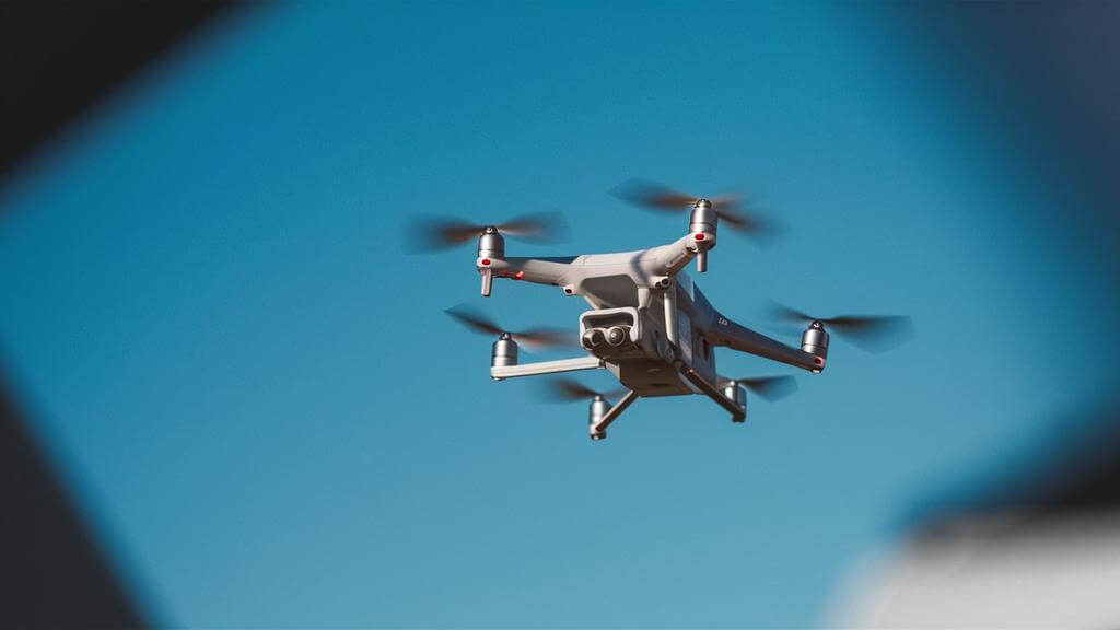
Alt text: T-DRONES VA25 in flight, showcasing aerial capabilities within legal restrictions.
2. What are Drone Altitude Regulations in Other Countries?
While the 400-foot limit is common, drone altitude regulations vary significantly across the globe. Understanding these differences is vital for drone pilots operating internationally. Here’s a glimpse at some specific country regulations:
| Continent | Country | Maximum Altitude (feet/meters) |
|---|---|---|
| Europe | France | 492 feet (150 meters) |
| Europe | Germany | 230 feet (70 meters) for recreational; 492 feet (150 meters) for commercial |
| Europe | Italy | 230 feet (70 meters) for recreational; 492 feet (150 meters) for commercial |
| Europe | Netherlands | 394 feet (120 meters) |
| Europe | Poland | 492 feet (150 meters) |
| Europe | Russia | 492 feet (150 meters) |
| Europe | Spain | 384 feet (120 meters) |
| Europe | Ukraine | 400 feet (122 meters) |
| Europe | United Kingdom | 400 feet (122 meters) |
| Asia | China | 400 feet (122 meters) |
| Asia | India | 400 feet (122 meters) |
| Asia | Indonesia | 500 feet (150 meters) |
| Asia | Israel | 400 feet (122 meters) |
| Asia | Japan | 492 feet (150 meters) |
| Asia | Pakistan | 400 feet (122 meters) |
| Asia | Singapore | 200 feet (61 meters) |
| Asia | South Korea | 492 feet (150 meters) |
| Asia | Thailand | 300 feet (91 meters) |
| Asia | Turkey | 400 feet (122 meters) |
| North America | Canada | 400 feet (122 meters) |
| North America | Mexico | 400 feet (122 meters) |
| North America | Panama | 400 feet (122 meters) |
| North America | United States | 400 feet (122 meters) |
| South America | Argentina | 400 feet (122 meters) |
| South America | Brazil | 400 feet (122 meters) |
| South America | Chile | 400 feet (122 meters) |
| Africa | South Africa | 400 feet (122 meters) |
| Oceania | Australia | 400 feet (122 meters) |
Key Considerations for International Drone Flights
- Thorough Research: Before flying in any country, conduct comprehensive research on local drone regulations. Aviation authorities’ websites and drone-specific resources are excellent sources.
- Registration and Permits: Some countries require drone registration or permits for operation. Ensure you fulfill these requirements before flying.
- Airspace Awareness: Be aware of restricted airspace areas, such as airports, military installations, and national parks.
- Language Barriers: If you don’t speak the local language, consider using translation apps or resources to understand regulations and communicate with local authorities if necessary.
According to the International Air Transport Association (IATA), global harmonization of drone regulations is an ongoing process. However, significant differences still exist, making it imperative for drone pilots to stay informed and compliant.
Alt text: T-DRONES VA23 soaring in the sky, exemplifying the importance of adhering to international drone altitude laws.
3. What are the Altitude Capabilities of Different Drone Types?
Drones come in various shapes and sizes, each designed for specific purposes and with varying altitude capabilities. While legal restrictions apply, understanding the technical limits of different drone types is helpful.
-
Toy Drones: These lightweight, entry-level drones typically have a maximum altitude of 100 to 150 feet. They’re designed for indoor or backyard use and prioritize ease of use over performance.
-
Racing Drones: Built for speed and agility, racing drones usually operate within a range of 100 to 200 feet. This lower altitude allows for close-range maneuvering and maintaining visual line-of-sight during races.
-
Consumer Drones: Popular among hobbyists and photographers, consumer drones often have a potential altitude of 1,000 feet or more. However, their firmware typically limits them to 400 feet to comply with regulations.
-
Civilian Drones: Used for research, environmental monitoring, and non-commercial applications, civilian drones can typically fly up to 1,500 feet. They often feature advanced navigation and stabilization systems.
-
Commercial Drones: These advanced drones can reach altitudes exceeding 22,000 feet. Equipped with powerful motors and sophisticated navigation, they’re used for aerial surveys, inspections, and high-altitude photography.
-
Police and Government Drones: Employed for surveillance, monitoring, and emergency response, these drones often fly at altitudes around 11,200 feet, balancing wide-area coverage with detailed image capture.
-
Military Drones: Engineered for reconnaissance, surveillance, and combat missions, military drones can operate at altitudes over 50,000 feet. They feature advanced propulsion systems and state-of-the-art navigation technologies.
Altitude and Drone Performance
Keep in mind that a drone’s maximum potential altitude doesn’t always translate to optimal performance. Factors like wind, temperature, and air density can affect a drone’s ability to climb and maintain altitude.
Alt text: Assortment of drone types, illustrating the diversity in design and altitude capabilities for various applications.
4. What Factors Affect How High a Drone Can Fly?
A multitude of factors influence a drone’s flying altitude, encompassing design elements, environmental conditions, and operational parameters. Grasping these elements is vital for maximizing a drone’s altitude capabilities safely and effectively.
Technical Design and Capabilities
- Motor Power: The power of the drone’s motors directly impacts its ability to generate lift. More powerful motors enable higher altitude flight.
- Propeller Efficiency: Efficient propellers translate motor power into lift more effectively.
- Drone Weight: A lighter drone requires less power to ascend, leading to higher potential altitudes.
- Battery Technology: Advanced battery technology provides the energy needed for sustained high-altitude flight.
Operational Parameters
-
Battery Life: Longer battery life allows for extended flight times, enabling drones to climb higher and stay aloft longer.
-
Flight Duration: The longer a drone can stay airborne, the higher it can potentially climb.
-
Payload Capacity: The ability to carry additional weight without compromising flight performance is crucial.
-
Signal Transmission and Control Range: As a drone flies higher, the distance from its controller increases, which can weaken the signal and potentially lead to loss of control.
Environmental Conditions
- Atmospheric Pressure and Air Density: With increasing altitude, air pressure drops, and air becomes less dense, making it harder for drones to generate the necessary lift.
- Temperature: Lower temperatures at higher altitudes can affect battery performance, reducing power and potentially causing malfunctions.
- Wind and Turbulence: Increased wind speeds and turbulence at higher altitudes can challenge a drone’s stability and control.
- Flying in Mountainous Terrain: Mountains can cause signal bounce and interference, affecting the drone’s ability to maintain a stable connection with the controller.
The Impact of Air Density
Air density plays a significant role in a drone’s ability to fly at higher altitudes. According to a study by NASA, air density decreases exponentially with increasing altitude, affecting both lift and drag. This means that drones require more power to generate the same amount of lift at higher altitudes.
Alt text: VTOL Drone in flight, showcasing its ability to navigate diverse environmental conditions and maintain altitude effectively.
5. How to Ensure Your Drone Stays Below Legal Limits
Maintaining compliance with altitude restrictions is crucial for safe and legal drone operation. Here are several strategies to help you stay within the limits:
Utilizing Built-In Limiters and Software
- Familiarize Yourself with Drone Settings: Modern drones are equipped with built-in altitude limiters that prevent exceeding legal altitude limits.
- Regular Firmware Updates: Keep your drone’s firmware updated, as manufacturers often include enhancements or new features that improve altitude control.
- Customize Altitude Settings: If your drone allows, customize the altitude settings based on your flight plan and local regulations.
Continuous Altitude Monitoring
- Use Controller Displays: Most drone controllers have a display showing real-time altitude. Always keep an eye on this during flight.
- Mobile Device Apps: Utilize mobile apps connected to your drone for a more detailed view of your drone’s altitude and other flight parameters.
- Set Altitude Alerts: If your drone’s software allows, set up alerts to notify you when approaching the maximum altitude limit.
Strategic Flight Planning
- Survey the Area: Before flying, survey the area for any tall structures, trees, or natural features that might necessitate altitude adjustments.
- Use Mapping Tools: Utilize drone mapping tools or apps to pre-plan your flight path, taking into account the terrain and any potential obstacles.
- Adjust for Local Regulations: Be aware of local regulations that might affect your flight path, especially in urban or controlled airspace areas.
Understanding Visual Line of Sight (VLOS)
Maintaining visual line of sight (VLOS) is not only an FAA requirement but also a critical safety measure. VLOS helps you maintain awareness of your drone’s surroundings and avoid potential hazards.
 How to Make Sure You Stay Below the Limits
Alt text: Ensuring drone flight within legal limits with software, flight planning, and altitude monitoring.
6. What are the Altitude Restrictions Near Airports?
Flying a drone near an airport is highly regulated due to the potential safety hazards. Understanding and adhering to FAA regulations is crucial for safe and legal operation in these areas.
FAA Regulations Near Airports
- Proximity Restrictions: Drones must generally stay at least 5 miles away from airports, but there are shielded operation exceptions.
- Altitude Limits: In controlled airspace, the maximum altitude for drone flights is often capped at 400 feet AGL, but the exact limit can vary.
- Class G Airspace: In uncontrolled (Class G) airspace, drones can fly up to 400 feet AGL without prior authorization, but pilots must still be cautious.
Obtaining Authorization
- FAA Authorization: Pilots must obtain authorization from the FAA through the Low Altitude Authorization and Notification Capability (LAANC) system or the FAA DroneZone website.
- Compliance with Part 107 Rules: Commercial drone operators must comply with Part 107 rules, including obtaining necessary permissions for flying in controlled airspace.
- Using LAANC and B4UFLY App: The LAANC system provides near-instant authorization, while the B4UFLY app offers real-time information on airspace restrictions.
Understanding Airspace Classifications
Airspace is classified into different categories, each with its own set of rules and restrictions. Understanding these classifications is essential for safe drone operation near airports:
- Class B: Surrounds the nation’s busiest airports. Requires specific authorization and communication with air traffic control.
- Class C: Surrounds airports with a moderate amount of traffic. Requires authorization through LAANC or DroneZone.
- Class D: Surrounds airports with control towers. Requires authorization through LAANC or DroneZone.
- Class E: Controlled airspace that doesn’t fall into Class B, C, or D. May require authorization depending on altitude and proximity to airports.
- Class G: Uncontrolled airspace. Drones can fly up to 400 feet AGL without prior authorization, but pilots must still be cautious.
By understanding and adhering to these regulations, drone pilots can help ensure the safety of both manned and unmanned aircraft in the vicinity of airports.
Alt text: Illustrating drone altitude regulations near airports to ensure safe airspace operations.
7. How Does Remote ID Affect Drone Flight?
Remote Identification (Remote ID) is a critical component of drone operation, acting as a digital license plate for drones and enhancing airspace safety.
What is Remote ID?
Remote ID enables drones to transmit identification and location information, which can be received by other parties through a broadcast signal. This technology helps to identify and track drones in flight, enhancing airspace awareness and safety.
FAA’s Remote ID Requirements
The FAA mandates Remote ID for most drones operating in U.S. airspace. There are three main ways to comply:
- Standard Remote ID Drones: These drones broadcast Remote ID information directly from the drone.
- Broadcast Module: Drones without built-in Remote ID can use a broadcast module to transmit the required information.
- FAA-Recognized Identification Areas (FRIAs): These designated areas allow drones to operate without Remote ID.
Benefits of Remote ID
- Enhanced Airspace Awareness: Remote ID allows manned aircraft and other airspace users to identify and track drones, improving overall airspace safety.
- Improved Accountability: Remote ID helps to identify drone operators who violate regulations or operate recklessly.
- Integration into the National Airspace System: Remote ID is a key step in integrating drones safely into the national airspace system.
8. What Sensors Measure a Drone’s Altitude?
Drones utilize various sensors to measure altitude accurately, ensuring safe and controlled flight.
Barometric Pressure Sensors
Barometric pressure sensors calculate altitude by measuring atmospheric pressure, which decreases as altitude increases. These sensors provide accurate and reliable altitude data, especially at lower altitudes.
GPS Sensors
GPS sensors determine altitude by triangulating the drone’s position relative to satellites. While GPS sensors can provide altitude data, they are generally less accurate than barometric pressure sensors, particularly in areas with poor satellite coverage.
Ultrasonic Sensors
Some drones also use ultrasonic sensors to measure altitude, especially at very low altitudes. These sensors emit ultrasonic waves and measure the time it takes for the waves to bounce back, providing a precise measurement of the drone’s distance from the ground.
Sensor Fusion
Many advanced drones use a combination of these sensors to provide the most accurate and reliable altitude data. This process, known as sensor fusion, combines data from multiple sensors to compensate for the limitations of each individual sensor.
9. What Happens if You Violate Altitude Restrictions?
Flying a drone above the legal altitude limits can lead to significant consequences.
Risks of Flying Above 400 Feet
- Collision with Aircraft: The most serious risk is the potential collision with manned aircraft.
- Losing Signal: Higher altitudes increase the chance of losing the control signal.
- Environmental Factors: Strong winds and colder temperatures can affect drone performance.
Legal Consequences
- Fines: The FAA can impose fines ranging from $1,100 to $27,500 for violating altitude restrictions. In severe cases, fines can reach up to $400,000.
- Suspension or Revocation of Flying Privileges: The FAA can suspend or revoke your drone flying privileges, impacting your ability to legally operate drones in the future.
- Criminal Charges: In egregious cases, violating altitude restrictions can lead to criminal charges.
10. What is the Highest Altitude a Drone Has Ever Reached?
Drones have achieved remarkable altitudes, pushing the boundaries of what’s possible in aerial technology.
The Airbus Zephyr
The Airbus Zephyr, a solar-powered drone, reached an astounding altitude of 76,100 feet (23,195 meters) in 2021 and maintained flight for over 18 days. Designed for high-altitude, long-endurance missions, the Zephyr represents the pinnacle of drone altitude capabilities.
Other High-Altitude Drones
While the Zephyr holds the record for the highest altitude, other drones have also achieved impressive altitudes:
- Military Drones: Some military drones can operate at altitudes over 50,000 feet, enabling them to perform reconnaissance and surveillance missions while avoiding detection.
- Commercial Drones: Advanced commercial drones can reach altitudes exceeding 22,000 feet, allowing them to perform aerial surveys and inspections over large areas.
These high-altitude drones demonstrate the potential of drone technology for a wide range of applications, from scientific research to military operations.
FAQs
What Is the Highest a Drone Has Ever Flown?
The highest altitude ever achieved by a drone was 76,100 feet (23,195 meters) by the Airbus Zephyr in 2021.
What Happens if You Fly a Drone Above 400 Feet?
Flying above 400 feet can lead to collisions, signal loss, environmental risks, and legal consequences, including fines and suspension of flying privileges.
Can the FAA Track Your Drone?
Yes, the FAA can track drones through Remote Identification (Remote ID), which transmits identification and location information.
Which Sensor Is Used to Measure the Altitude of a Drone?
Drones commonly use barometric pressure sensors and GPS sensors to measure altitude.
Can I Fly My Drone Over People?
Flying over people is restricted by the FAA and generally requires a waiver or specific operational conditions.
Do I Need a License to Fly a Drone?
Commercial drone operators need a Part 107 certification, while recreational flyers must follow specific rules and guidelines.
What Is the Maximum Speed a Drone Can Fly?
The FAA limits drone speed to 87 mph (140 km/h or 75 knots).
How Far Can a Drone Fly From the Controller?
The maximum range depends on the drone and controller but is typically several miles, although VLOS must be maintained.
Are There No-Fly Zones for Drones?
Yes, no-fly zones include airports, military bases, and national parks, among others.
Can I Fly My Drone at Night?
Flying at night requires specific FAA authorization and adherence to safety guidelines.
At flyermedia.net, we are committed to providing you with the most up-to-date and comprehensive information on drone regulations, safety guidelines, and best practices. Whether you’re a recreational flyer or a commercial operator, we have the resources you need to fly safely and legally.
Ready to explore the world of drones?
- Find flight schools: Discover top-rated flight schools near you and start your journey to becoming a certified drone pilot.
- Get the latest aviation news: Stay informed about the latest developments in drone technology and regulations.
- Explore career opportunities: Learn about exciting career opportunities in the drone industry.
Visit flyermedia.net today and unlock your potential in the exciting world of drones. Contact us at Address: 600 S Clyde Morris Blvd, Daytona Beach, FL 32114, United States. Phone: +1 (386) 226-6000. Website: flyermedia.net.