How High Can You Fly A Drone Legally? The legal altitude for drone flights is a critical consideration for every drone pilot. At flyermedia.net, we’re here to guide you through the regulations and best practices for safe and legal drone operations, so you can navigate the skies responsibly. Let’s explore the permissible drone altitude to enhance safety and ensure adherence to aviation laws.
1. Understanding Legal Drone Altitude Limits
How high can you fly a drone legally? The definitive answer is typically up to 400 feet above ground level (AGL) in the United States, as mandated by the Federal Aviation Administration (FAA). This regulation is in place to prevent conflicts with manned aircraft. However, there are exceptions, such as flying within 400 feet of a structure, where you can fly up to 400 feet above the structure’s immediate uppermost limit. Always check local regulations and airspace restrictions before flying, as these can vary.
Understanding these regulations is essential for safe and legal drone operations. According to the FAA’s Part 107 rules, drone pilots must adhere to specific altitude restrictions to avoid potential collisions with manned aircraft. The 400-foot limit is a standard benchmark, but it’s also important to consider the immediate surroundings. For instance, if you are inspecting a tall building, you are allowed to fly up to 400 feet above the structure’s highest point, provided you remain within a 400-foot radius of it.
Moreover, airspace classifications play a critical role in determining where and how high you can legally fly a drone. Airspace is categorized into different classes (A, B, C, D, E, and G), each with its own set of regulations. For example, flying near airports often involves more stringent restrictions, sometimes requiring permission from air traffic control. Always use resources like the FAA’s UAS Facility Maps or apps like B4UFLY to check the airspace before initiating a flight. These tools provide real-time information about airspace restrictions, temporary flight restrictions (TFRs), and other important advisories.
Staying informed about these rules helps ensure that you operate your drone safely and legally, preventing potential fines and more serious repercussions. The FAA continuously updates its regulations, so regular review and education are key for every drone pilot.
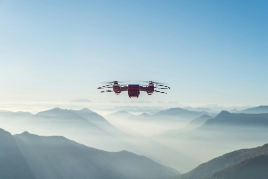 drone-flying-over-city
1.1. FAA Regulations on Drone Altitude
What are the specific FAA regulations on drone altitude? The FAA sets the standard altitude limit at 400 feet AGL for unmanned aircraft systems (UAS) operations under Part 107. Understanding these regulations is vital for every drone pilot to ensure compliance and safety.
The FAA’s Part 107 regulations are the cornerstone of legal drone operations in the United States. These rules stipulate that drones must not be flown higher than 400 feet above ground level (AGL). However, there is an exception when operating within a 400-foot radius of a structure, allowing drones to fly up to 400 feet above the structure’s immediate uppermost limit. This provision is particularly relevant for inspections and aerial photography around buildings, towers, and other tall structures.
Furthermore, the FAA mandates that drone pilots maintain visual line of sight (VLOS) with their drones at all times, unless they have obtained a waiver for beyond visual line of sight (BVLOS) operations. This requirement is critical for situational awareness and avoiding collisions with other aircraft or obstacles.
Airspace restrictions also play a significant role in determining permissible drone altitudes. Certain airspaces, such as those near airports (Class B, C, and D airspace), have more stringent requirements and may necessitate obtaining permission from air traffic control (ATC) before flying. The FAA provides resources like the UAS Facility Maps and the B4UFLY app to help drone pilots identify airspace classifications and any associated restrictions. These tools offer real-time information about controlled airspace, prohibited areas, and temporary flight restrictions (TFRs).
Violating FAA regulations can result in significant penalties, including fines, suspension or revocation of remote pilot certificates, and even criminal charges in severe cases. Therefore, staying informed about the latest FAA guidelines and utilizing available resources is crucial for all drone pilots. Regular review of FAA updates and participation in ongoing education programs can help ensure continued compliance and promote safe drone operations.
1.2. Understanding AGL (Above Ground Level)
What does AGL (Above Ground Level) mean in drone regulations? AGL refers to the height of the drone relative to the ground directly beneath it, not the height above sea level. This measurement is crucial for adhering to the FAA’s 400-foot altitude limit.
Above Ground Level (AGL) is a fundamental concept in aviation and drone operations, serving as the standard measurement for altitude relative to the ground directly beneath the aircraft. Unlike Mean Sea Level (MSL), which measures altitude relative to the average sea level, AGL provides a more accurate representation of a drone’s height concerning its immediate surroundings. This distinction is particularly important in areas with varying elevations, such as hilly or mountainous terrain, where MSL altitude can be misleading.
The FAA uses AGL as the primary reference for altitude restrictions to ensure that drones maintain a safe distance from obstacles and other aircraft. The 400-foot AGL limit, for instance, is designed to prevent drones from interfering with manned aircraft operations and to reduce the risk of collisions with buildings, trees, and power lines.
Understanding AGL is crucial for drone pilots to comply with regulations and maintain safe flying practices. Pilots must be aware of the terrain over which they are flying and continuously adjust their drone’s altitude to stay within the legal limits. This requires careful monitoring of the drone’s telemetry data and visual observation of the surroundings.
Furthermore, when operating near structures, the FAA allows drones to fly up to 400 feet above the immediate uppermost limit of the structure, as long as the drone remains within a 400-foot radius of the structure. This exception necessitates a clear understanding of AGL, as pilots must accurately assess the height of the structure and adjust their drone’s altitude accordingly.
To ensure compliance with AGL regulations, drone pilots should utilize tools such as topographic maps, GPS devices, and altitude monitoring systems. These resources provide valuable information about ground elevation and assist in maintaining accurate altitude control. Additionally, regular training and education on aviation regulations and best practices are essential for all drone pilots.
1.3. Maximum Altitude for Recreational vs. Commercial Drone Use
Is there a difference in altitude limits for recreational and commercial drone use? Both recreational and commercial drone pilots generally adhere to the 400-foot AGL limit, but commercial operations may have additional requirements or the possibility of waivers for specific situations.
For both recreational and commercial drone operations, the standard maximum altitude is generally capped at 400 feet above ground level (AGL), as mandated by the FAA. This regulation is designed to ensure the safety of the national airspace and prevent potential conflicts with manned aircraft. However, there are nuances and exceptions that differentiate the requirements for recreational and commercial drone use.
Recreational drone pilots, who fly their drones purely for enjoyment, must adhere to the FAA’s recreational rules, which include flying within visual line of sight (VLOS), avoiding interference with manned aircraft, and complying with community-based safety guidelines. While the 400-foot altitude limit applies, recreational pilots are not required to obtain a Remote Pilot Certificate under Part 107, provided they meet certain conditions, such as flying for hobby or recreational purposes only.
Commercial drone pilots, on the other hand, operate under Part 107 regulations, which require them to obtain a Remote Pilot Certificate by passing an aeronautical knowledge test. While they also adhere to the 400-foot AGL limit, commercial operators have the option to apply for waivers from certain restrictions, including altitude limits, under specific circumstances. For example, a commercial drone pilot may seek a waiver to fly above 400 feet AGL to inspect a tall structure, provided they can demonstrate that the operation can be conducted safely.
Additionally, commercial drone operations often involve more complex scenarios, such as beyond visual line of sight (BVLOS) flights, night operations, and flights over people, which require additional certifications, equipment, and operational protocols. These advanced operations are subject to FAA approval and may involve specific altitude considerations to ensure safety.
2. What Happens If You Fly Above the Legal Limit?
What are the consequences of flying a drone above the legal altitude limit? Violations can lead to fines, suspension or revocation of your drone pilot certificate, and potential legal action, emphasizing the importance of compliance with FAA regulations.
Flying a drone above the legal altitude limit can result in a range of consequences, from monetary fines to the suspension or revocation of your drone pilot certificate, and even potential legal action. The FAA takes airspace violations seriously, as they can pose significant safety risks to manned aircraft and other airspace users. Understanding the potential ramifications of non-compliance is crucial for all drone pilots.
One of the primary consequences of violating altitude restrictions is the imposition of civil penalties. The FAA can issue fines ranging from hundreds to thousands of dollars, depending on the severity of the violation and the pilot’s history of compliance. Factors considered in determining the penalty amount include the altitude overage, the proximity to controlled airspace or airports, and any potential risk to other aircraft or people on the ground.
In addition to fines, the FAA has the authority to suspend or revoke a drone pilot’s Remote Pilot Certificate if they are found to have violated altitude regulations. This can have significant implications for commercial drone operators, as it can impact their ability to conduct business and earn income. The duration of the suspension or revocation depends on the nature and severity of the violation, as well as the pilot’s overall safety record.
In more serious cases, flying a drone above the legal altitude limit can lead to legal action, particularly if the violation results in an accident, injury, or property damage. The FAA may refer the case to the Department of Justice for criminal prosecution, which could result in significant fines, imprisonment, and a permanent criminal record.
Moreover, violating altitude regulations can have indirect consequences, such as increased insurance premiums and difficulty obtaining future waivers or authorizations from the FAA. Insurance companies may view pilots with a history of violations as higher risk and charge accordingly, while the FAA may be less likely to grant waivers or authorizations to pilots with a poor safety record.
3. How to Determine Legal Flying Height
How can you accurately determine the legal flying height for your drone? Use tools like aviation maps, GPS, and drone flight apps to monitor your altitude and stay within the 400-foot AGL limit.
Accurately determining the legal flying height for your drone is essential for compliance with FAA regulations and ensuring safe operations. Several tools and techniques can help drone pilots monitor their altitude and stay within the 400-foot AGL limit.
One of the primary tools for determining legal flying height is the use of aviation maps and charts. These maps provide detailed information about airspace classifications, controlled airspace boundaries, and known obstacles, such as towers and buildings. By consulting these maps before and during a flight, drone pilots can identify potential altitude restrictions and plan their flight paths accordingly.
GPS technology is another valuable resource for determining legal flying height. Most modern drones are equipped with GPS receivers that provide real-time altitude data, allowing pilots to monitor their height above ground level. This information is typically displayed on the drone’s remote controller or a connected mobile app.
Drone flight apps, such as DJI Fly, Litchi, and DroneDeploy, offer a range of features to assist pilots in maintaining safe altitudes. These apps often include built-in airspace maps, altitude alerts, and geofencing capabilities that can be customized to prevent the drone from exceeding pre-set altitude limits.
In addition to these tools, visual observation is crucial for determining legal flying height. Pilots should continuously scan their surroundings for potential obstacles and adjust their drone’s altitude as needed to maintain a safe distance. This is particularly important when flying in areas with varying terrain or near structures.
Furthermore, understanding the concept of Above Ground Level (AGL) versus Mean Sea Level (MSL) is essential for accurately determining legal flying height. AGL refers to the height of the drone relative to the ground directly beneath it, while MSL refers to the height above average sea level. Since the FAA’s altitude limit is based on AGL, pilots must account for changes in ground elevation when planning their flights.
Regular training and education on aviation regulations and best practices are also essential for determining legal flying height. Drone pilots should stay informed about the latest FAA guidelines and participate in ongoing education programs to enhance their knowledge and skills.
3.1. Using Aviation Maps and Charts
How do aviation maps and charts help in determining legal drone flying height? They provide crucial information about airspace classifications, controlled airspace boundaries, and known obstacles, enabling pilots to plan flights accordingly.
Aviation maps and charts are indispensable tools for drone pilots, offering critical information about airspace classifications, controlled airspace boundaries, and known obstacles that can impact flight planning and safety. These maps are designed to provide a comprehensive overview of the airspace environment, enabling pilots to make informed decisions about where and how high they can legally fly their drones.
One of the primary uses of aviation maps is to identify airspace classifications. Airspace is categorized into different classes (A, B, C, D, E, and G), each with its own set of regulations and restrictions. For example, Class B airspace surrounds major airports and typically requires permission from air traffic control (ATC) before flying. By consulting aviation maps, drone pilots can determine the airspace class in their area of operation and comply with the corresponding regulations.
Aviation maps also depict controlled airspace boundaries, indicating the areas where ATC has authority over aircraft operations. These boundaries are essential for drone pilots to avoid unauthorized entry into controlled airspace, which can result in significant penalties. Maps typically show the lateral and vertical limits of controlled airspace, allowing pilots to plan their flight paths to remain clear of these areas.
In addition to airspace information, aviation maps highlight known obstacles, such as towers, buildings, and power lines, that can pose a hazard to drone operations. These obstacles are often depicted with their height above ground level (AGL), enabling pilots to assess the potential risks and maintain a safe distance. Maps may also indicate the presence of temporary flight restrictions (TFRs) or other special use airspace, which can affect flight planning.
Several types of aviation maps are available, including sectional charts, terminal area charts, and VFR flyway planning charts. Sectional charts provide a broad overview of the airspace environment, while terminal area charts offer more detailed information about airspace near major airports. VFR flyway planning charts are designed to assist pilots in navigating around congested areas and avoiding conflicts with other aircraft.
Drone pilots can access aviation maps and charts through various sources, including the FAA’s website, mobile apps, and online mapping services. It is essential to use up-to-date maps and charts, as airspace classifications and obstacle information can change frequently.
3.2. GPS and Altitude Monitoring Systems
How do GPS and altitude monitoring systems assist in maintaining legal drone flying height? They provide real-time altitude data, enabling pilots to monitor their height above ground level and stay within the 400-foot AGL limit.
GPS (Global Positioning System) and altitude monitoring systems are essential tools for drone pilots, providing real-time data on altitude, position, and speed. These systems enable pilots to maintain legal flying heights and avoid potential collisions with obstacles or other aircraft. By continuously monitoring their drone’s altitude, pilots can make informed decisions about flight paths and ensure compliance with FAA regulations.
One of the primary functions of GPS in drone operations is to provide accurate altitude data. GPS receivers use signals from multiple satellites to determine the drone’s precise location and altitude above sea level (MSL). This information is then converted to altitude above ground level (AGL) using terrain elevation data. The AGL altitude is crucial for drone pilots, as it is the reference point for the FAA’s 400-foot altitude limit.
Altitude monitoring systems typically consist of sensors, such as barometers and ultrasonic sensors, that measure the drone’s height relative to the ground. Barometers measure air pressure, which decreases with altitude, while ultrasonic sensors emit sound waves and measure the time it takes for the waves to return, indicating the distance to the ground. These sensors provide accurate altitude data, even in areas where GPS signals are weak or unavailable.
The data from GPS and altitude monitoring systems is typically displayed on the drone’s remote controller or a connected mobile app. Pilots can view their drone’s altitude in real-time and receive alerts if they approach or exceed the 400-foot AGL limit. Some drones also have built-in geofencing capabilities, which allow pilots to set altitude limits and prevent the drone from flying above a specified height.
In addition to altitude monitoring, GPS and altitude monitoring systems provide valuable information about the drone’s position and speed. This information is essential for maintaining situational awareness and avoiding collisions with obstacles or other aircraft. Pilots can use GPS data to plan their flight paths, monitor their progress, and track their drone’s location in case of an emergency.
3.3. Utilizing Drone Flight Apps for Altitude Awareness
How do drone flight apps enhance altitude awareness and compliance? They offer built-in airspace maps, altitude alerts, and customizable geofencing capabilities to prevent drones from exceeding pre-set altitude limits.
Drone flight apps have become indispensable tools for drone pilots, offering a range of features designed to enhance safety, improve flight performance, and ensure compliance with regulations. One of the key benefits of these apps is their ability to enhance altitude awareness and help pilots maintain legal flying heights. By providing real-time altitude data, airspace information, and customizable alerts, drone flight apps empower pilots to make informed decisions and avoid potential violations.
Many drone flight apps include built-in airspace maps that display airspace classifications, controlled airspace boundaries, and known obstacles. These maps are typically overlaid on a satellite or street map, providing a visual representation of the airspace environment. Pilots can use these maps to identify potential altitude restrictions and plan their flight paths accordingly. Some apps also offer real-time updates on temporary flight restrictions (TFRs) and other special use airspace, ensuring that pilots have the most current information available.
In addition to airspace maps, drone flight apps often provide altitude alerts that notify pilots when they approach or exceed pre-set altitude limits. These alerts can be customized to trigger at specific altitudes, giving pilots ample warning to adjust their flight path and avoid potential violations. Some apps also offer visual cues, such as color-coded altitude indicators, to help pilots quickly assess their drone’s height relative to the ground.
Customizable geofencing capabilities are another valuable feature of drone flight apps. Geofences allow pilots to define virtual boundaries around a specific area and set altitude limits within those boundaries. If the drone approaches or exceeds the geofence, the app will trigger an alert, and in some cases, automatically prevent the drone from flying outside the designated area. This feature is particularly useful for ensuring compliance with altitude restrictions in sensitive areas, such as near airports or populated areas.
Examples of popular drone flight apps that offer these features include DJI Fly, Litchi, DroneDeploy, and Pix4Dcapture. These apps are compatible with a wide range of drone models and offer user-friendly interfaces that make it easy for pilots to access and interpret altitude information.
4. Exceptions to the 400-Foot Rule
Are there exceptions to the 400-foot altitude rule? Yes, such as flying within 400 feet of a structure or obtaining waivers for specific commercial operations, but these require FAA approval and adherence to strict guidelines.
While the FAA’s 400-foot altitude rule is a standard guideline for drone operations, there are exceptions that allow pilots to fly above this limit under specific circumstances. These exceptions are typically granted for commercial operations or when flying near structures, but they require FAA approval and adherence to strict guidelines. Understanding these exceptions is crucial for drone pilots who need to operate above 400 feet AGL.
One of the most common exceptions to the 400-foot rule is when flying within 400 feet of a structure. According to the FAA, drone pilots are allowed to fly up to 400 feet above the immediate uppermost limit of a structure, provided they remain within a 400-foot radius of the structure. This exception is often used for inspections of tall buildings, bridges, and towers.
However, to take advantage of this exception, pilots must adhere to certain requirements. They must ensure that the drone remains within 400 feet of the structure at all times and that the operation does not pose a hazard to other aircraft or people on the ground. It is also recommended to notify the local air traffic control (ATC) facility before conducting such operations.
Another exception to the 400-foot rule is obtaining waivers for specific commercial operations. The FAA allows commercial drone pilots to apply for waivers from certain regulations, including altitude limits, under Part 107 of the Federal Aviation Regulations. To obtain a waiver, pilots must demonstrate that their proposed operation can be conducted safely and without endangering other airspace users.
The waiver application process typically involves submitting a detailed description of the proposed operation, including the purpose of the flight, the altitude requested, the equipment used, and the safety procedures in place. The FAA will review the application and may require additional information or modifications before granting the waiver.
In addition to these exceptions, there may be other circumstances where flying above 400 feet AGL is permitted, such as during emergency situations or with special authorization from the FAA. However, it is always the pilot’s responsibility to ensure that they are operating legally and safely.
4.1. Flying Near Structures
What are the rules for flying a drone near structures exceeding 400 feet? You can fly up to 400 feet above the structure’s immediate uppermost limit, as long as you remain within a 400-foot radius of the structure.
When operating a drone near structures that exceed 400 feet in height, specific rules and guidelines must be followed to ensure safety and compliance with FAA regulations. These rules allow drone pilots to fly above the standard 400-foot AGL limit, provided they remain within a certain proximity to the structure and adhere to certain operational requirements. Understanding these rules is crucial for conducting inspections, aerial photography, and other commercial operations near tall buildings, bridges, and towers.
According to the FAA, drone pilots are allowed to fly up to 400 feet above the immediate uppermost limit of a structure, as long as they remain within a 400-foot radius of the structure. This means that if a building is 800 feet tall, a drone pilot can fly up to 1200 feet AGL while remaining within 400 feet of the building. However, as soon as the drone moves outside the 400-foot radius, it must adhere to the standard 400-foot AGL limit.
To comply with these rules, drone pilots must accurately determine the height of the structure and maintain a constant awareness of their drone’s position relative to the structure. This can be achieved using GPS technology, altitude monitoring systems, and visual observation. It is also recommended to use drone flight apps that provide real-time data on altitude and distance from the structure.
In addition to the altitude and proximity requirements, drone pilots must also adhere to other FAA regulations, such as maintaining visual line of sight (VLOS) with the drone, avoiding operations over people, and complying with airspace restrictions. It is also recommended to notify the local air traffic control (ATC) facility before conducting operations near structures exceeding 400 feet.
Furthermore, drone pilots should conduct a thorough risk assessment before flying near structures to identify potential hazards and implement appropriate safety measures. This may include factors such as wind conditions, weather conditions, the presence of other aircraft, and the proximity to power lines and other obstacles.
4.2. Waivers and Authorizations for Higher Altitudes
How can you obtain a waiver or authorization to fly at higher altitudes? Apply to the FAA with a detailed plan demonstrating how the operation can be conducted safely, including specific safety measures and equipment.
Obtaining a waiver or authorization to fly a drone at higher altitudes requires a thorough understanding of FAA regulations and a detailed plan demonstrating how the operation can be conducted safely. The FAA allows commercial drone pilots to apply for waivers from certain regulations, including altitude limits, under Part 107 of the Federal Aviation Regulations. The process involves submitting a comprehensive application that outlines the purpose of the flight, the altitude requested, the equipment used, and the safety procedures in place.
The first step in obtaining a waiver or authorization is to determine the specific regulation from which you need a waiver. In the case of altitude limits, the relevant regulation is typically § 107.51, which restricts drone operations to a maximum altitude of 400 feet AGL. Once you have identified the regulation, you can begin preparing your waiver application.
The application must include a detailed description of the proposed operation, including the location, date, and time of the flight, as well as the purpose of the flight and the altitude requested. You must also provide a justification for why the waiver is necessary and explain why the operation cannot be conducted within the standard altitude limits.
In addition to the operational details, the waiver application must include a comprehensive safety plan that demonstrates how the operation can be conducted safely. This plan should address potential hazards, such as collisions with other aircraft, loss of control, and operations over people, and outline the safety measures that will be implemented to mitigate these risks. Examples of safety measures include using redundant equipment, establishing a safety zone, and training personnel.
The FAA will review the waiver application and may request additional information or modifications before granting the waiver. The review process can take several weeks or months, so it is important to submit the application well in advance of the proposed flight.
Once the waiver is granted, it is important to comply with all the conditions and limitations specified in the waiver. Failure to do so can result in penalties, including fines, suspension or revocation of your Remote Pilot Certificate, and even legal action.
5. Safety Guidelines for Flying at Any Altitude
What are some essential safety guidelines to follow when flying a drone at any altitude? Always maintain visual line of sight, monitor weather conditions, avoid flying over people, and ensure your drone is well-maintained.
When operating a drone, regardless of the altitude, adhering to safety guidelines is paramount to ensure the well-being of people on the ground, protect property, and prevent collisions with other aircraft. These guidelines encompass a range of factors, from pre-flight checks and weather considerations to airspace awareness and emergency procedures. By following these safety measures, drone pilots can minimize risks and operate their drones responsibly.
One of the most fundamental safety guidelines is to always maintain visual line of sight (VLOS) with the drone. This means that the pilot must be able to see the drone with their unaided vision at all times during the flight. VLOS is essential for maintaining situational awareness and avoiding collisions with obstacles or other aircraft. If the pilot cannot maintain VLOS, they should terminate the flight immediately.
Weather conditions can significantly impact drone operations, so it is important to monitor weather forecasts and avoid flying in adverse conditions. Strong winds, rain, snow, and fog can all affect the drone’s stability, visibility, and battery life. Pilots should also be aware of temperature extremes, which can impact the drone’s performance and battery efficiency.
Flying over people is generally prohibited unless the drone is specifically designed and certified for operations over people. Even in those cases, pilots should minimize the time spent flying over people and take precautions to reduce the risk of injury in the event of a crash. It is also important to respect people’s privacy and avoid capturing images or videos without their consent.
Proper maintenance is essential for ensuring the safe and reliable operation of a drone. Pilots should conduct pre-flight inspections to check the drone’s components, batteries, propellers, and control systems. Any damaged or worn parts should be replaced before flying. Regular maintenance and inspections can help identify potential problems before they lead to an accident.
Before each flight, pilots should check airspace restrictions and comply with all applicable regulations. This includes avoiding controlled airspace without authorization, respecting altitude limits, and avoiding restricted areas, such as airports, military bases, and national parks. Pilots should also be aware of temporary flight restrictions (TFRs) and other special use airspace.
5.1. Maintaining Visual Line of Sight (VLOS)
Why is maintaining visual line of sight (VLOS) so critical for drone safety? VLOS allows the pilot to react quickly to hazards, avoid collisions, and maintain control of the drone.
Maintaining Visual Line of Sight (VLOS) is a cornerstone of safe drone operations and a fundamental requirement of most aviation regulations. VLOS refers to the ability of the drone pilot to see the drone with their unaided vision at all times during the flight. This means that the pilot must be able to visually track the drone’s position, altitude, and orientation without relying on electronic aids, such as video screens or goggles.
VLOS is critical for several reasons. First, it allows the pilot to maintain situational awareness and detect potential hazards, such as other aircraft, obstacles, or people on the ground. By visually observing the drone, the pilot can react quickly to avoid collisions or other dangerous situations.
Second, VLOS enables the pilot to maintain control of the drone. If the drone experiences a malfunction or encounters unexpected conditions, the pilot can use visual cues to make adjustments and prevent a crash. For example, if the drone is drifting due to wind, the pilot can visually assess the situation and take corrective action.
Third, VLOS is essential for complying with aviation regulations. Most aviation authorities, including the FAA in the United States, require drone pilots to maintain VLOS with their drones unless they have obtained a waiver for beyond visual line of sight (BVLOS) operations. VLOS helps ensure that the pilot can see and avoid other aircraft, comply with airspace restrictions, and operate the drone safely.
Maintaining VLOS can be challenging, especially in certain environments. Factors such as distance, weather conditions, and terrain can all affect the pilot’s ability to see the drone. To maintain VLOS, pilots should choose a flying location that provides a clear view of the drone, avoid flying in adverse weather conditions, and use visual aids, such as binoculars, if necessary.
In some cases, it may be difficult or impossible to maintain VLOS with the drone. For example, when inspecting a tall building or bridge, the drone may fly behind the structure, temporarily obscuring it from the pilot’s view. In these situations, it is important to have a spotter who can maintain VLOS and communicate with the pilot.
5.2. Weather Considerations
How do weather conditions impact drone flight safety? Strong winds, rain, snow, and fog can all affect a drone’s stability, visibility, and battery life, making it crucial to check weather forecasts before flying.
Weather conditions play a critical role in drone flight safety, and it is essential for pilots to assess and consider these factors before each flight. Adverse weather conditions, such as strong winds, rain, snow, and fog, can significantly impact a drone’s stability, visibility, and battery life, increasing the risk of accidents and incidents. By understanding how weather affects drone performance, pilots can make informed decisions and take appropriate precautions to ensure safe operations.
Strong winds can be particularly hazardous for drones, as they can cause the drone to drift, lose altitude, or even crash. Drones are generally designed to handle moderate wind speeds, but strong gusts can overwhelm the drone’s control systems and make it difficult to maintain a stable flight path. Pilots should check wind forecasts before flying and avoid flying in areas with high winds or turbulent conditions.
Rain and snow can also pose significant risks to drones. Water can damage the drone’s electronic components, causing malfunctions or even complete failure. Snow can accumulate on the drone’s propellers, reducing their efficiency and increasing the risk of a crash. Pilots should avoid flying in rain or snow, and if caught in inclement weather, they should land the drone as soon as possible.
Fog can reduce visibility, making it difficult for pilots to maintain visual line of sight (VLOS) with the drone. Reduced visibility can also increase the risk of collisions with obstacles or other aircraft. Pilots should avoid flying in fog, and if fog develops during a flight, they should land the drone immediately.
Temperature extremes can also affect drone performance. High temperatures can cause the drone’s batteries to overheat, reducing their efficiency and lifespan. Low temperatures can reduce battery capacity and make the drone more susceptible to malfunctions. Pilots should be aware of temperature forecasts and take precautions to protect the drone from extreme temperatures.
Before each flight, pilots should check weather forecasts and assess the potential impact on drone operations. They should also be prepared to postpone or cancel flights if weather conditions are unfavorable.
5.3. Avoiding Operations Over People
Why is it important to avoid flying a drone over people? Doing so increases the risk of injury or property damage in case of a malfunction or crash.
Avoiding operations over people is a fundamental safety principle in drone operations, as it significantly reduces the risk of injury or property damage in the event of a malfunction or crash. While drones are becoming increasingly reliable, there is always a possibility of mechanical failure, software glitches, or human error that could lead to a loss of control. By avoiding flying over people, pilots can minimize the potential consequences of such incidents.
The FAA has specific regulations regarding operations over people, which vary depending on the type of drone, the nature of the operation, and the level of risk involved. In general, the FAA prohibits drone operations over people unless certain conditions are met. These conditions may include using a drone that is specifically designed and certified for operations over people, obtaining a waiver from the FAA, or complying with specific operational requirements.
Even when operations over people are permitted, it is important to take precautions to reduce the risk of injury. This may include using a drone with safety features, such as propeller guards and parachute systems, establishing a safety zone around the drone, and providing training to personnel on emergency procedures.
Pilots should also be aware of the potential for privacy violations when flying over people. It is important to respect people’s privacy and avoid capturing images or videos without their consent. Pilots should also be mindful of local laws and regulations regarding privacy and surveillance.
When planning a drone operation, pilots should carefully assess the potential risks of flying over people and take steps to minimize those risks. This may involve choosing a flight path that avoids populated areas, flying at a higher altitude, or postponing the operation until a time when fewer people are present.
In some cases, it may be necessary to obtain permission from property owners or event organizers before flying over their property. This is especially important when flying over private events, such as concerts or sporting events.
6. Maintaining Your Drone for Safe Flights
How does proper drone maintenance contribute to flight safety? Regular inspections and maintenance can identify potential issues before they lead to accidents, ensuring the drone operates reliably.
Maintaining your drone is a critical aspect of ensuring safe flights and preventing accidents. Regular inspections and maintenance can identify potential issues before they escalate into major problems, ensuring that the drone operates reliably and predictably. A well-maintained drone is less likely to experience malfunctions or failures that could lead to a loss of control or a crash.
One of the most important aspects of drone maintenance is conducting pre-flight inspections. Before each flight, pilots should carefully inspect the drone’s components, including the propellers, motors, batteries, and control systems. They should check for any signs of damage, wear, or loose connections. If any problems are found, they should be addressed before flying.
Propellers are particularly important to inspect, as they are responsible for generating lift and thrust. Damaged or worn propellers can reduce the drone’s performance and increase the risk of a crash. Pilots should check the propellers for cracks, chips, and bends, and replace them if necessary.
Motors should also be inspected regularly, as they are responsible for powering the propellers. Pilots should check the motors for unusual noises, vibrations, or overheating. If any problems are detected, they should be addressed by a qualified technician.
Batteries are a critical component of any drone, and they should be maintained properly to ensure optimal performance and longevity. Pilots should follow the manufacturer’s instructions for charging, storing, and handling batteries. They should also avoid exposing batteries to extreme temperatures or humidity.
Control systems, including the remote controller and flight software, should be updated regularly to ensure that they are functioning properly. Pilots should also calibrate the drone’s sensors and GPS system before each flight.
In addition to pre-flight inspections, drones should undergo periodic maintenance by a qualified technician. This may include cleaning the drone’s components, lubricating moving parts, and replacing worn or damaged parts. Regular maintenance can help extend the life of the drone and prevent costly repairs.
6.1. Pre-Flight Checks
What pre-flight checks are essential for ensuring drone safety? Inspect propellers, motors, batteries, control systems, and ensure all systems are functioning correctly before takeoff.
Performing thorough pre-flight checks is essential for ensuring drone safety and preventing accidents. Pre-flight checks involve systematically inspecting the drone’s components, systems, and software to identify any potential issues before takeoff. By identifying and addressing problems before flying, pilots can minimize the risk of malfunctions, failures, and loss of control.
One of the first steps in pre-flight checks is to inspect the propellers. Propellers are responsible for generating lift and thrust, and any damage or wear can significantly impact the drone’s performance. Pilots should check the propellers for cracks, chips, bends, and loose connections. If any problems are found, the propellers should be replaced before flying.
Next, pilots should inspect the motors. Motors power the propellers, and any issues with the motors can affect the drone’s stability and control. Pilots should check the motors for unusual noises, vibrations, or overheating. If any problems are detected, the motors should be inspected by a qualified technician.
Batteries are another critical component to inspect before each flight. Batteries provide power to the drone’s motors and electronic systems, and any issues with the batteries can lead to a sudden loss of power. Pilots should check the batteries for damage, swelling, or leaks. They should also ensure that the batteries are fully charged and properly installed.
Control systems, including the remote controller and flight software, should be checked to ensure that they are