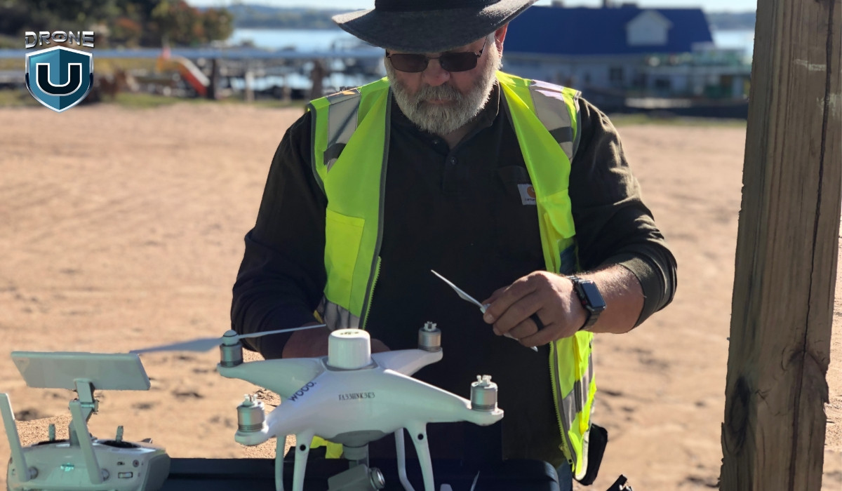
How Far Away Can You Fly A Drone Legally? Understanding the legal limits of drone flight distance is crucial for every drone pilot. At flyermedia.net, we break down the FAA regulations and guidelines, ensuring you stay compliant and safe while enjoying your UAV. Explore airspace restrictions, visual line of sight rules, and Remote ID requirements to maximize your drone’s potential within legal boundaries. Discover the essentials of drone operation, including VLOS, airspace restrictions, and the importance of Remote ID compliance.
Table of Contents
- Quick Overview of Legal Drone Flight Distance
- Understanding FAA Regulations on Drone Flight Distance
- Visual Line of Sight (VLOS) and Legal Flight Distance
- Maximum Legal Altitude for Drone Flight
- Remote ID and Its Impact on Drone Flight Distance
- Legal Flight Distance for Recreational vs. Commercial Pilots
- Airspace Restrictions and Legal Flight Distance
- State and Local Laws Affecting Drone Flight Distance
- Technology to Extend Legal Drone Flight Distance
- Tips for Safe and Legal Drone Flights
- Frequently Asked Questions (FAQs)
1. Quick Overview of Legal Drone Flight Distance
Legally, how far away can you fly a drone? The primary FAA regulation is maintaining a visual line of sight (VLOS) with your drone at all times. This means you must be able to see the drone with your own eyes (without the aid of binoculars or other vision-enhancing devices, unless they are prescribed to you). The specific distance this translates to depends on weather conditions, the size of your drone, and your visual acuity, but generally, it’s within a few hundred feet. Compliance with Remote ID requirements is also mandatory for most drone flights, ensuring your drone’s identification and location are broadcast during flight.
- Visual Line of Sight (VLOS): Keep your drone within your sight at all times.
- Remote ID: Ensure your drone complies with Remote ID regulations.
- Airspace Restrictions: Be aware of no-fly zones and airspace limitations.
- Altitude Limits: Fly at or below 400 feet in uncontrolled airspace.
- FAA Guidelines: Follow all FAA safety guidelines for drone operation.
2. Understanding FAA Regulations on Drone Flight Distance
The Federal Aviation Administration (FAA) sets the rules for drone operation in the United States. These regulations are designed to ensure safety and prevent interference with manned aircraft. Understanding these rules is critical for every drone pilot, whether you’re flying for recreation or commercial purposes.
 FAA New Rules and Drone Laws in the USA
Key FAA Regulations
- Part 107: This regulation covers commercial drone operations. To fly under Part 107, you need to obtain a Remote Pilot Certificate. This involves passing an initial aeronautical knowledge exam and meeting specific eligibility requirements, such as being at least 16 years old and able to understand English.
- TRUST (The Recreational UAS Safety Test): If you’re flying for recreational purposes, you must pass the TRUST exam and carry proof of completion while flying your drone.
- Remote ID: Since September 16, 2023, most drones must comply with Remote ID regulations, broadcasting identification and location information during flight.
- Visual Line of Sight (VLOS): You must maintain VLOS with your drone at all times.
Specific Regulations
| Regulation | Description |
|---|---|
| Visual Line of Sight | Pilots must be able to see the drone with their own eyes without any vision-enhancing devices (unless prescribed). |
| Altitude Limit | Drones must be flown at or below 400 feet in uncontrolled airspace. |
| Airspace Restrictions | Pilots need to be aware of and avoid no-fly zones, especially around airports and other restricted areas. Tools like the B4UFLY app can help identify these areas. |
| Remote ID Compliance | Drones must broadcast identification and location information during flight, either through a built-in Remote ID system, an add-on module, or by flying within an FAA-Recognized Identification Area (FRIA). |
| Registration | Drones weighing over 0.55 lbs (250g) must be registered with the FAA. |
| Night Operations | Night flights are allowed under Part 107 with proper airspace authorization in controlled airspace under 400 feet. |
| Operations Over People | Allowed under Part 107 as long as specific rules are followed. |
| Alcohol and Drugs | Flying a drone under the influence of drugs or alcohol is strictly prohibited. |
| Operating Safely | Always give way to and do not interfere with other aircraft. |
FAA Resources
- FAA Website: The FAA’s official website provides up-to-date information on drone regulations, safety guidelines, and registration processes.
- B4UFLY Mobile App: This app uses your GPS location to provide real-time information about airspace restrictions and other flying requirements.
- DroneZone: The FAA’s DroneZone portal is used for drone registration and authorization.
Staying Updated
Drone regulations can change, so it’s essential to stay informed. Regularly check the FAA website and subscribe to industry newsletters to keep up with the latest updates.
Understanding and adhering to FAA regulations is critical for operating drones legally and safely. By following these guidelines, drone pilots can help ensure the safety of the national airspace and the public. For more information and resources, visit flyermedia.net.
3. Visual Line of Sight (VLOS) and Legal Flight Distance
What is the visual line of sight and how does it affect legal flight distance? The FAA mandates that drone pilots maintain visual line of sight (VLOS) with their drones at all times during flight. This means the pilot must be able to see the drone with their own eyes, without the aid of binoculars or other visual aids (unless specifically prescribed). This requirement is in place to ensure that the pilot can visually monitor the drone’s flight path, avoid obstacles, and maintain control of the aircraft.
 General UAS Flying Regulations
VLOS Defined
VLOS refers to the ability of the remote pilot to see the drone throughout the entire flight. This includes being able to:
- Determine the drone’s location.
- Understand the drone’s attitude, direction, and operational status.
- Observe the airspace for other aircraft or potential hazards.
Factors Affecting VLOS
Several factors can impact a pilot’s ability to maintain VLOS:
- Weather Conditions: Fog, rain, and haze can significantly reduce visibility.
- Distance: The farther the drone flies, the harder it becomes to see, especially for smaller drones.
- Obstacles: Buildings, trees, and other structures can obstruct the pilot’s view.
- Visual Acuity: A pilot’s eyesight and ability to discern small objects at a distance play a crucial role.
- Time of Day: Reduced visibility during dawn, dusk, or nighttime requires additional precautions and often specific waivers for commercial operations.
Extending VLOS
While the FAA generally requires unaided VLOS, there are situations where a visual observer can be used to help maintain visual contact with the drone. This is often the case in more complex operations or when flying in areas with potential obstructions.
- Visual Observer (VO): A VO is a trained individual who assists the remote pilot in maintaining VLOS. The VO must be in direct communication with the pilot and be able to immediately communicate any hazards or deviations from the intended flight path.
- Regulations for VO: The FAA specifies that the remote pilot in command (PIC) is responsible for ensuring that the VO can effectively see the drone and communicate any necessary information.
Consequences of Violating VLOS
Failing to maintain VLOS can result in serious consequences, including:
- Fines and Penalties: The FAA can impose significant fines for violating VLOS regulations.
- Certificate Suspension or Revocation: For commercial pilots, repeated or egregious violations can lead to suspension or revocation of their Remote Pilot Certificate.
- Accidents and Incidents: Loss of VLOS can increase the risk of accidents, property damage, and personal injury.
Tips for Maintaining VLOS
- Choose the Right Drone: Smaller drones are harder to see at a distance. Consider using a larger drone with high-visibility markings.
- Plan Your Flight: Scout the area beforehand to identify potential obstacles and plan a flight path that minimizes obstructions.
- Use a Visual Observer: If necessary, use a trained VO to help maintain VLOS, especially in complex environments.
- Monitor Weather Conditions: Be aware of weather conditions that could affect visibility, and avoid flying in adverse weather.
- Take Breaks: Extended periods of concentration can lead to fatigue and reduced visual acuity. Take regular breaks to rest your eyes.
Technological Aids and VLOS
The FAA generally prohibits the use of visual aids like binoculars, but there are exceptions for pilots who require corrective lenses. However, technology is evolving, and there are ongoing discussions about the potential for advanced systems to enhance VLOS.
- Augmented Reality (AR): AR technology could potentially overlay flight information onto the pilot’s view, helping them maintain situational awareness.
- Enhanced Vision Systems (EVS): EVS uses sensors to provide a clearer view in low-visibility conditions.
Maintaining visual line of sight is a fundamental requirement for safe and legal drone operation. By understanding the regulations, factors affecting VLOS, and tips for maintaining visual contact, drone pilots can ensure they are flying responsibly and in compliance with FAA guidelines. For more detailed information and resources, visit flyermedia.net.
4. Maximum Legal Altitude for Drone Flight
What is the maximum legal altitude for drone flight, and how is it regulated? The FAA sets a maximum altitude limit of 400 feet above ground level (AGL) for drone flights in uncontrolled airspace (Class G airspace). This regulation is in place to separate drone operations from manned aircraft, which typically operate at higher altitudes.
 Drone Regulations for Recreational Pilots
Understanding the 400-Foot Rule
The 400-foot rule is a key component of drone regulations in the United States. It applies to both recreational and commercial drone pilots and is designed to minimize the risk of collisions with manned aircraft.
- Uncontrolled Airspace (Class G): In Class G airspace, drones are generally allowed to fly up to 400 feet AGL without any additional authorization.
- Controlled Airspace: In controlled airspace (Class B, C, D, and E), drone pilots need to obtain authorization from the FAA before flying, even if they stay below 400 feet.
Exceptions to the 400-Foot Rule
There are a few exceptions to the 400-foot rule, primarily related to flying near structures:
- Proximity to Structures: According to 14 CFR § 107.51, drones can be flown higher than 400 feet AGL when operating within a 400-foot radius of a structure, as long as the drone remains within that radius. In this case, the drone can be flown up to 400 feet above the structure’s immediate uppermost limit.
Airspace Classification and Altitude
Understanding airspace classification is crucial for determining where and how high you can fly your drone.
| Airspace Class | Description | Altitude Restrictions |
|---|---|---|
| Class A | Generally, airspace from 18,000 feet mean sea level (MSL) up to and including flight level (FL) 600 (60,000 feet MSL). Used by airliners, corporate jets. | Drone flights are typically prohibited. |
| Class B | Airspace surrounding the nation’s busiest airports. | Requires specific authorization from air traffic control (ATC) and compliance with all ATC instructions. |
| Class C | Airspace surrounding airports that have an operational control tower, are serviced by a radar approach control, and have a certain number of instrument flight rule (IFR) operations. | Requires authorization through LAANC or DroneZone. |
| Class D | Airspace surrounding airports with an operational control tower. | Requires authorization through LAANC or DroneZone. |
| Class E | Controlled airspace that is not Class A, B, C, or D. | May require authorization depending on the specific location and altitude. |
| Class G | Uncontrolled airspace. | Drones can be flown up to 400 feet AGL without authorization. |
| Special Use Airspace | Includes prohibited areas, restricted areas, warning areas, military operation areas (MOAs), and alert areas. | Restrictions vary depending on the specific type of special use airspace. Pilots should check NOTAMs (Notices to Airmen) and other resources to determine any restrictions in these areas. |
Obtaining Authorizations for Controlled Airspace
To fly in controlled airspace, drone pilots need to obtain authorization from the FAA. The primary methods for obtaining authorization are:
- Low Altitude Authorization and Notification Capability (LAANC): LAANC provides near real-time automated airspace authorization for Part 107 pilots. It’s the fastest and most efficient way to get approval to fly in controlled airspace.
- DroneZone: For areas where LAANC is not available, pilots can submit a request through the FAA’s DroneZone portal. This process typically takes longer than LAANC authorization.
Tools for Determining Airspace
Several tools can help drone pilots determine the airspace classification and any restrictions in their area:
- B4UFLY App: This app provides real-time information about airspace restrictions and other flying requirements.
- sectional Charts: These are aeronautical charts that provide detailed information about airspace, airports, and other navigational information.
- Drone Apps: Many drone apps include airspace maps and tools to help pilots plan their flights safely.
Consequences of Violating Altitude Restrictions
Violating altitude restrictions can result in serious consequences, including:
- Fines and Penalties: The FAA can impose significant fines for violating altitude regulations.
- Certificate Suspension or Revocation: For commercial pilots, repeated or egregious violations can lead to suspension or revocation of their Remote Pilot Certificate.
- Safety Risks: Flying above the legal altitude increases the risk of collisions with manned aircraft.
Tips for Complying with Altitude Restrictions
- Plan Your Flight: Before each flight, check the airspace in your area and plan your flight to stay within legal altitude limits.
- Use a Drone App: Use a drone app that provides real-time airspace information and altitude tracking.
- Monitor Altitude: Pay attention to your drone’s altitude during flight and make sure you are not exceeding the 400-foot limit.
- Obtain Authorization: If you need to fly in controlled airspace, obtain the necessary authorization through LAANC or DroneZone.
Complying with altitude restrictions is essential for safe and legal drone operation. By understanding the regulations, airspace classifications, and available tools, drone pilots can ensure they are flying responsibly and in compliance with FAA guidelines. For more detailed information and resources, visit flyermedia.net.
5. Remote ID and Its Impact on Drone Flight Distance
How does Remote ID impact the legal distance you can fly a drone? Remote ID is a critical component of drone regulations in the United States, impacting how far you can legally fly your drone. Implemented by the FAA, Remote ID requires drones to broadcast identification and location information during flight, functioning like a “digital license plate” for drones. This technology allows authorities and other airspace users to identify and locate drones in flight, enhancing safety and accountability.
 Regulations for Foreigners Visiting the USA
Understanding Remote ID
Remote ID is designed to provide identification and location information about drones in flight. This information includes:
- Drone Identification: The unique serial number of the drone or, in some cases, the registration number assigned by the FAA.
- Location Information: The current location of the drone, including latitude, longitude, altitude, and velocity.
- Control Station Location: The location of the drone’s control station (i.e., the pilot’s location).
- Operational Status: An indication of the drone’s operational status, such as whether it is in flight or stationary.
Types of Remote ID Compliance
There are three primary ways to comply with Remote ID requirements:
- Standard Remote ID Drone: Drones with built-in Remote ID capability that broadcast the required information directly from the drone.
- Remote ID Broadcast Module: An add-on module that can be attached to existing drones to broadcast Remote ID information. This allows older drones to comply with the regulations without needing to be replaced.
- FAA-Recognized Identification Area (FRIA): A designated area where drones without Remote ID can be flown. These areas are typically established by community-based organizations (CBOs) or educational institutions.
Impact on Legal Flight Distance
Remote ID primarily affects legal flight distance by enabling better monitoring and enforcement of drone regulations. Here’s how:
- Enhanced Enforcement: Remote ID makes it easier for law enforcement to identify drones that are flying illegally or in restricted areas. This can lead to increased enforcement and penalties for non-compliance.
- Increased Accountability: By providing identification information, Remote ID increases accountability for drone pilots, encouraging them to fly responsibly and follow the rules.
- Improved Airspace Awareness: Remote ID allows other airspace users, such as manned aircraft pilots, to be aware of drone operations in their vicinity, enhancing overall airspace safety.
Compliance Requirements
As of September 16, 2023, most drone pilots are required to comply with Remote ID regulations. Here are the key compliance requirements:
- Registration: All drones that require registration with the FAA must comply with Remote ID regulations.
- Operation: Drones must broadcast Remote ID information during flight, either through a built-in system or an add-on module.
- FRIAs: If operating a drone without Remote ID, flights must be conducted within an FAA-Recognized Identification Area (FRIA).
Exemptions and Waivers
While Remote ID is broadly required, there are some limited exemptions and waivers available:
- Limited Operations: The FAA may grant waivers for certain types of operations that cannot comply with Remote ID requirements, such as research and development activities.
- FRIAs: As mentioned above, operating within a FRIA allows pilots to fly drones without Remote ID, but these areas are subject to specific restrictions and requirements.
Tools for Remote ID Compliance
Several tools and resources are available to help drone pilots comply with Remote ID regulations:
- FAA Website: The FAA’s website provides detailed information about Remote ID requirements, compliance options, and available resources.
- Drone Manufacturers: Many drone manufacturers offer drones with built-in Remote ID capability.
- Remote ID Module Providers: Several companies offer add-on Remote ID modules that can be attached to existing drones.
- Community-Based Organizations (CBOs): CBOs can provide guidance and support for drone pilots seeking to comply with Remote ID regulations, including establishing FRIAs.
Consequences of Non-Compliance
Failing to comply with Remote ID regulations can result in serious consequences, including:
- Fines and Penalties: The FAA can impose significant fines for operating a drone without Remote ID compliance.
- Certificate Suspension or Revocation: For commercial pilots, repeated or egregious violations can lead to suspension or revocation of their Remote Pilot Certificate.
- Legal Action: In some cases, non-compliance with Remote ID regulations can result in legal action.
Remote ID is a critical component of drone regulations in the United States, impacting how far you can legally fly your drone. By understanding the requirements, compliance options, and available resources, drone pilots can ensure they are flying responsibly and in compliance with FAA guidelines. For more detailed information and resources, visit flyermedia.net.
6. Legal Flight Distance for Recreational vs. Commercial Pilots
Is there a difference in legal flight distance for recreational and commercial drone pilots? The FAA distinguishes between recreational and commercial drone pilots, with specific regulations tailored to each category. While the fundamental rules regarding visual line of sight (VLOS) and altitude limits apply to both, there are some differences in the requirements and restrictions that can indirectly affect the legal flight distance.
 Drone Regulations For Commercial Drone Pilots
Recreational Drone Pilots
Recreational drone pilots fly drones for hobby or personal enjoyment. The key regulations for recreational pilots include:
- TRUST (The Recreational UAS Safety Test): Recreational pilots must pass the TRUST exam and carry proof of completion while flying their drone.
- Visual Line of Sight (VLOS): Maintain visual line of sight with the drone at all times.
- Altitude Limit: Fly at or below 400 feet in Class G (uncontrolled) airspace.
- Airspace Authorization: Obtain proper authorization through LAANC or DroneZone before flying in controlled airspace (Class B, Class C, Class D, and Class E airspace).
- Registration: Keep a current FAA registration, mark drones on the outside with the registration number, and carry proof of registration during all flights.
- FAA Guidelines: Follow the safety guidelines of an FAA-recognized Community Based Organization (CBO).
Commercial Drone Pilots
Commercial drone pilots fly drones for work or business purposes. The key regulations for commercial pilots include:
- Part 107 License: To fly drones commercially, you must obtain a Remote Pilot Certificate – Part 107 license from the FAA.
- Aeronautical Knowledge Exam: Pass the initial aeronautical knowledge exam: “Unmanned Aircraft General – Small (UAG)”.
- Age Requirement: Be at least 16 years old.
- English Proficiency: Be able to understand, read, write, and speak English.
- Mental and Physical Condition: Be mentally and physically able to operate a UAV safely.
- Night Operations: You can fly drones at night, over people, and moving vehicles without a waiver under Part 107 as long as the rules are followed. However, airspace authorization is still needed for night operations in controlled airspace under 400 feet.
Differences Affecting Legal Flight Distance
-
Waivers and Authorizations:
- Commercial Pilots: Commercial pilots operating under Part 107 can apply for waivers to certain regulations, such as VLOS requirements or altitude limits, if they can demonstrate that their operations can be conducted safely. This flexibility can potentially allow them to fly drones farther than recreational pilots, provided they obtain the necessary waivers.
- Recreational Pilots: Recreational pilots have fewer options for obtaining waivers and are generally subject to stricter adherence to the standard regulations.
-
Operational Complexity:
- Commercial Pilots: Commercial operations often involve more complex flight scenarios, such as flying in urban areas, conducting inspections of infrastructure, or mapping large areas. These operations may require the use of visual observers or advanced technologies to maintain VLOS, which can indirectly affect the legal flight distance.
- Recreational Pilots: Recreational flights are typically less complex and often conducted in open areas, making it easier to maintain VLOS without the need for additional support.
-
Training and Certification:
- Commercial Pilots: The Part 107 certification process requires commercial pilots to demonstrate a higher level of knowledge and skill compared to recreational pilots. This includes understanding airspace regulations, weather conditions, and emergency procedures. This enhanced training can enable commercial pilots to make more informed decisions about flight planning and risk management, potentially allowing them to operate safely over longer distances.
- Recreational Pilots: The TRUST exam is a basic safety test that does not require the same level of knowledge as the Part 107 exam. This can limit the ability of recreational pilots to assess risks and make informed decisions about flight operations.
VLOS and Flight Distance
Regardless of whether you are a recreational or commercial pilot, the fundamental requirement to maintain visual line of sight (VLOS) is critical. This means that the pilot must be able to see the drone with their own eyes at all times during flight, without the aid of binoculars or other visual aids (unless specifically prescribed).
The specific distance that a pilot can legally fly a drone while maintaining VLOS depends on several factors, including:
- Weather Conditions: Fog, rain, and haze can significantly reduce visibility, limiting the legal flight distance.
- Drone Size: Smaller drones are harder to see at a distance, which can also limit the legal flight distance.
- Pilot’s Visual Acuity: A pilot’s eyesight and ability to discern small objects at a distance play a crucial role in maintaining VLOS.
- Obstacles: Buildings, trees, and other structures can obstruct the pilot’s view, limiting the legal flight distance.
While the basic regulations regarding VLOS and altitude limits apply to both recreational and commercial drone pilots, there are some differences in the requirements and restrictions that can indirectly affect the legal flight distance. Commercial pilots operating under Part 107 have more flexibility to obtain waivers and conduct complex operations, while recreational pilots are generally subject to stricter adherence to the standard regulations. Regardless of the category, all drone pilots must prioritize safety and comply with all applicable FAA regulations. For more detailed information and resources, visit flyermedia.net.
7. Airspace Restrictions and Legal Flight Distance
How do airspace restrictions affect the legal distance you can fly a drone? Airspace restrictions play a significant role in determining the legal distance you can fly a drone. The FAA classifies airspace into different categories, each with its own set of rules and restrictions. Understanding these classifications is essential for drone pilots to ensure they are flying legally and safely.
General UAS Flying Regulations
Airspace Classifications
The FAA classifies airspace into several categories, each with its own set of rules and restrictions. The primary airspace classifications relevant to drone pilots include:
- Class A: Airspace from 18,000 feet mean sea level (MSL) up to and including flight level (FL) 600 (60,000 feet MSL). Drone flights are typically prohibited in Class A airspace.
- Class B: Airspace surrounding the nation’s busiest airports. Requires specific authorization from air traffic control (ATC) and compliance with all ATC instructions.
- Class C: Airspace surrounding airports that have an operational control tower, are serviced by a radar approach control, and have a certain number of instrument flight rule (IFR) operations. Requires authorization through LAANC or DroneZone.
- Class D: Airspace surrounding airports with an operational control tower. Requires authorization through LAANC or DroneZone.
- Class E: Controlled airspace that is not Class A, B, C, or D. May require authorization depending on the specific location and altitude.
- Class G: Uncontrolled airspace. Drones can be flown up to 400 feet AGL without authorization.
- Special Use Airspace: Includes prohibited areas, restricted areas, warning areas, military operation areas (MOAs), and alert areas. Restrictions vary depending on the specific type of special use airspace. Pilots should check NOTAMs (Notices to Airmen) and other resources to determine any restrictions in these areas.
Impact on Legal Flight Distance
Airspace restrictions can directly impact the legal distance you can fly a drone in several ways:
-
No-Fly Zones:
- Certain areas are designated as no-fly zones, where drone flights are strictly prohibited. These areas typically include airports, military bases, prisons, and other sensitive locations. Flying a drone in a no-fly zone can result in significant fines and penalties.
- The B4UFLY app is a valuable tool for identifying no-fly zones and other airspace restrictions.
-
Altitude Restrictions:
- In controlled airspace (Class B, C, D, and E), drone pilots need to obtain authorization from the FAA before flying, even if they stay below 400 feet. This authorization process can limit the altitude at which you can fly, which can indirectly affect the legal flight distance.
- In uncontrolled airspace (Class G), drones can be flown up to 400 feet AGL without authorization.
-
Distance from Airports:
- The FAA has specific regulations regarding drone flights near airports. In general, drones are not allowed to be flown within a certain distance of an airport without authorization.
- The specific distance varies depending on the type of airport and the airspace classification.
- The FAA provides guidance on flying near airports and offers tools like LAANC to obtain authorization for flights in controlled airspace.
-
Special Use Airspace:
- Special use airspace includes areas such as prohibited areas, restricted areas, warning areas, military operation areas (MOAs), and alert areas.
- Each type of special use airspace has its own set of restrictions. For example, restricted areas may be temporarily activated for military training exercises, during which time drone flights are prohibited.
- Pilots should check NOTAMs (Notices to Airmen) and other resources to determine any restrictions in these areas before flying.
Obtaining Airspace Authorization
To fly in controlled airspace, drone pilots need to obtain authorization from the FAA. The primary methods for obtaining authorization are:
- Low Altitude Authorization and Notification Capability (LAANC): LAANC provides near real-time automated airspace authorization for Part 107 pilots. It’s the fastest and most efficient way to get approval to fly in controlled airspace.
- DroneZone: For areas where LAANC is not available, pilots can submit a request through the FAA’s DroneZone portal. This process typically takes longer than LAANC authorization.
Tools for Determining Airspace Restrictions
Several tools can help drone pilots determine the airspace classification and any restrictions in their area:
- B4UFLY App: This app provides real-time information about airspace restrictions and other flying requirements.
- Sectional Charts: These are aeronautical charts that provide detailed information about airspace, airports, and other navigational information.
- Drone Apps: Many drone apps include airspace maps and tools to help pilots plan their flights safely.
Airspace restrictions play a critical role in determining the legal distance you can fly a drone. By understanding the different airspace classifications, obtaining the necessary authorizations, and using available tools, drone pilots can ensure they are flying legally and safely. For more detailed information and resources, visit flyermedia.net.
8. State and Local Laws Affecting Drone Flight Distance
Do state and local laws affect how far you can legally fly a drone? Yes, in addition to federal regulations, state and local laws can also impact the legal distance you can fly a drone. While the FAA has primary authority over airspace, state and local governments can regulate drone operations in certain areas, such as privacy, harassment, and trespass.
Drone Regulations for Recreational Pilots
State Laws
Many states have enacted laws that regulate drone operations within their borders. These laws can vary widely from state to state, but some common themes include:
- Privacy: Some state laws prohibit or restrict the use of drones to record images or videos of individuals without their consent. These laws are designed to protect privacy rights and prevent drone pilots from engaging in voyeurism or harassment.
- Trespass: Many states have laws that prohibit drone pilots from flying over private property without the owner’s permission. These laws are based on the concept of trespass and are intended to protect property rights.
- Critical Infrastructure: Some states have laws that prohibit or restrict drone flights near critical infrastructure, such as power plants, water treatment facilities, and telecommunications facilities. These laws are designed to protect these facilities from potential security threats.
- Hunting and Fishing: Some states have laws that prohibit the use of drones for hunting or fishing activities. These laws are designed to protect wildlife and prevent unfair hunting practices.
- Law Enforcement: Some states have laws that regulate the use of drones by law enforcement agencies. These laws may require law enforcement to obtain a warrant before using a drone to conduct surveillance.
Local Laws
In addition to state laws, local governments, such as cities and counties, can also enact laws that regulate drone operations within their jurisdictions. These local laws can be even more restrictive than state laws and may include:
- Park Regulations: Many local parks have regulations that prohibit or restrict drone flights within park boundaries. These regulations are designed to protect park visitors, wildlife, and natural resources.
- Noise Ordinances: Some local governments have noise ordinances that limit the amount of noise that drones can produce. These ordinances are designed to protect residents from excessive noise pollution.
- Zoning Regulations: Local zoning regulations may restrict drone flights in certain areas, such as residential neighborhoods or business districts.
- Special Events: Local governments may temporarily restrict drone flights during special events, such as parades, concerts, or sporting events.
Examples of State and Local Laws
- California: California has several laws that regulate drone operations, including laws that address privacy, trespass, and law enforcement use of drones.
- Florida: Florida has laws that prohibit the use of drones to conduct surveillance or collect evidence without a warrant.
- Texas: Texas has laws that address the use of drones for surveillance and trespass.
- New York: New York has laws that regulate the use of drones by law enforcement and prohibit drone flights near correctional facilities.
Impact on Legal Flight Distance
State and local laws can impact the legal distance you can fly a drone by:
- Restricting Flight Locations: State and local laws may prohibit or restrict drone flights in certain areas, such as parks, residential neighborhoods, or near critical infrastructure.
- Imposing Altitude Restrictions: Some state and local laws may impose additional altitude restrictions on drone flights, which can limit the legal flight distance.
- Requiring Permits or Authorizations: Some state and local governments may require drone pilots to obtain permits or authorizations before flying in certain areas.
Staying Informed
It is essential for drone pilots to stay informed about state and local laws that may affect their operations. Here are some tips for staying informed:
- Check with State and Local Governments: Contact state and local governments to inquire about any laws or regulations that may apply to drone flights in your